

Trails Page
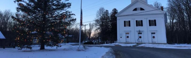
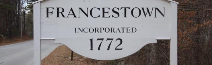
We are very fortunate in Francestown to have considerable town forests and public conservation lands, which support a wide variety of educational and recreational needs.
This page provides a summary of walking, hiking, and biking trails on town land. This page does not specifically cover class V or VI roads, including those designated as Class A or B trails, unless those roads are necessary for trail access.
In many cases, trails on town land connect to or form a network with trails on other conserved or publicly accessible properties, particularly properties conserved by the Francestown Land Trust (FLT) and the Turnpike Trails biking network. This page will not specifically cover trails on these third party properties, though those trails may appear on some of the maps.
To report issues or damage to trails, please file your report HERE.
General Guidelines to Public Trail Use on Town Properties
- Please stay on the trails to eliminate excessive trail widening or impacts. Stay off excessively wet trails when possible, especially with horses and bicycles.
- Dogs must remain on a leash at all times - this is to protect wildlife, other trail users, and sensitive natural environments (exception for hunting dogs in active hunting or training during hunting season).
- Motorized vehicles including ATVs and dirt bikes (motorcycles) are prohibited on town trails, due to the damaging effects these machines have on the trails (certain snowmobile exceptions exist). Currently, eBikes are classified as motorized vehicles. The conservation commission is currently developing policies around eBikes, please contact the commission if you wish to ride eBikes on town trails or have policy input.
- Practice good trail manners: Hikers yield to horses, and bicycles yield to both hikers and horses.
- Leave no trace, please pick up trash if you see it, and help to keep our trails clean and clear. If you wish to be more involved with local trail maintenance and development, contact the commission or request to join the Google group dedicated to Francestown Trails.
| Location | Trail | Distance | Difficulty | Best For | Map | Notes |
|---|---|---|---|---|---|---|
| Crotched Mtn Town Forest | Link Trail | 0.67 mi (each way) | * | Walk, Hike, Mtn Bike | Crotched Mountain Forest | The access trail for most other trails from Farrington Road parking, this is the left-hand trail just beyond the kiosk, which connects to Bullard Hill Road (Class VI) |
| Crotched Mtn Town Forest | Quarry Loop | 0.6 mi (loop) | * | Walk, Hike, Mtn Bike, Kids | (not shown on map) | Access from Farrington Road parking, this is the right-hand trail just beyond the kiosk, forms loop with part of Link trail |
| Crotched Mtn Town Forest | Scot's Trail | 2.8 mi (RT) | ** | Hike | Crotched Mountain Forest | Access from Farrington Road parking then Link trail, then Joslin Road or Bullard Hill Road (both Class VI) |
| Crotched Mtn Town Forest | Summit Loop | 5.7 mi (RT) from parking, including Link trail | **** | Hike | Crotched Mountain Forest | Access from Farrington Road parking then Link trail, 1100 feet of elevation gain |
| Crotched Mtn Town Forest | Upper Link | 1.0 RT from Summit Loop | **** | Hike | Crotched Mountain Forest | This trail extends the Summit Loop to the actual Crotched Mountain summit |
| Crotched Mtn Town Forest | Summit East Trail | 3.2 mi (to junction with Upper Link) | **** | Hike | Crotched Mountain Forest | Access from Farrington Road parking then Link trail |
| Crotched Mtn Town Forest | Summit West Trail | 2.4 mi (to junction with Upper Link) | **** | Hike | Crotched Mountain Forest | Access from Farrington Road parking then Link Trail |
| Crotched Mtn Town Forest | Lower Link | 0.47 mi | ** | Hike | Crotched Mountain Forest | This trail connects the Summit West Trail to Shannon's Trail (Greenfield) |
| Crotched Mtn Town Forest | Old Mountain Road | 0.52 mi one way (Bullard Hill to Summit East) + 0.8 mi further to Summit West | *** | Hike | Crotched Mountain Forest | This trail connects Bullard Hill Road to Summit West Trail, crossing Summit East Trail, access via any of these methods |
| Lord Town Forest | Trail | < 1.0 mi | * | Walk | Lord Forest Map | Access from Pherson Road |
| Fisher Hill Town Forest | Putnam Loop Trail | 0.75 mi | * | Hike, Mtn Bike | Fisher Hill Map | Access from parking area on Route 47 near Campbell Hill Road intersection, this is loop trail that starts and ends at an open area just down the access road behind the fence |
| Fisher Hill Town Forest | Fisher Hill Trail | 0.75 mi | ** | Hike, Mtn Bike | Fisher Hill Map | This trail is accessed from the Putnam Loop trail and goes up and around the five summits of Fisher Hill |
| Fisher Hill Town Forest | Perimeter Trail | 0.75 mi | ** | Hike, Mtn Bike | Fisher Hill Map | This trail is accessed from the Putnam Loop trail and provides an extension that makes for a more difficult loop around Fisher Hill |
| Driscoll Hill Town Forest | Draper Farm Trail | 1.1 mi (RT) | * | Hike, Mtn Bike | Rand Brook Map | Access off Driscoll Hill Road (Class VI) or via another trail; adjacent to FLT Rand Brook Forest |
| Dinsmore Brook Conservation Area | Various | 1-3 mi | ** | Walk, Hike, Mtn Bike | Dinsmore Brook Map | Best access is from small parking area off 2nd NH Turnpike N, 0.4 mi East of Crotched Mountain Golf Club. Alternate access from Old County Road North. |
| Shattuck Pond Town Forest | Shattuck Pond Trail | 2.2 mi (RT) from Pleasant Pond | ** | Hike | Shattuck Pond Map | Access from small parking area near Pleasant Pond, this trail links Pleasant Pond Road with Shattuck Pond road with optional side trail (additional distance) |
Notes:
- For difficulty ratings, more stars means more difficult
- Trails suitable for hiking or walking include snowshoeing
- Trails suitable for walking are also likely suitable for cross-country skiing